RiverTown
NetLogo Model used as an engineering water management exercise
Project maintained by VicCastillo Hosted on GitHub
RiverTown
This is an engineering water management exercise that allows the student to explore various options for water management around a community.
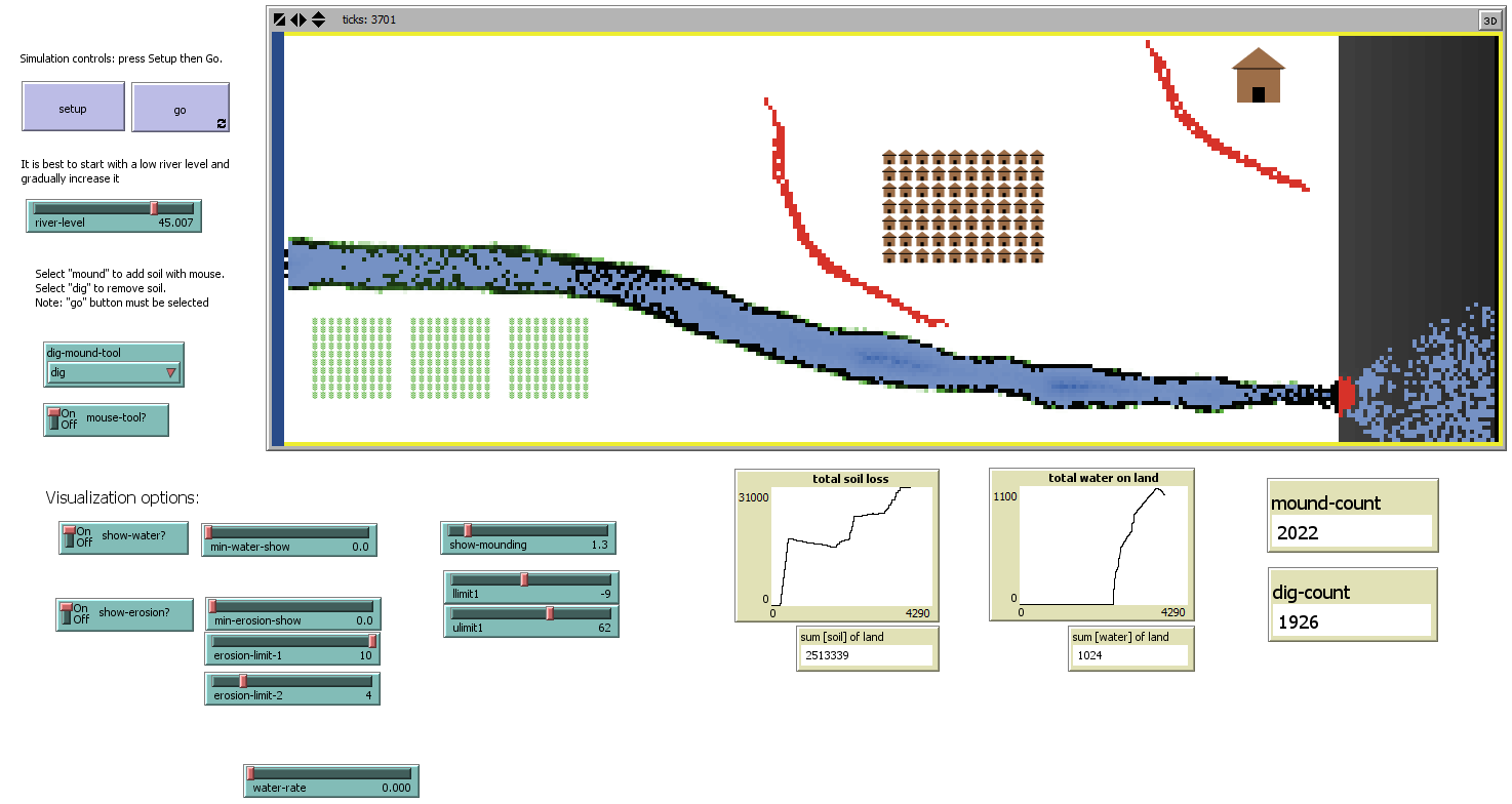
HOW IT WORKS
There is a river on the far left hand side whose level is controlled by a slider. A dig/mound tool allows the user to remove soil to (dig) create a basin, trench, ditch, or other waterway; or to (mound) create dikes or river banks.
HOW TO USE IT
press setup then go
slowly increase the river level using the slider and observe
press setup again
switch mouse-tool? on
select dig or mound
use the mouse to dig or mound
slowly increase the river level using the slider and observe
THINGS TO NOTICE
headward erosion threatens the orphanage near the cliff soil deposits are shown in red
THINGS TO TRY
Try to prevent flooding of the town headward erosion while irrigating the crops
EXTENDING THE MODEL
Crops could change depending on water conditions. Houses and orphanage could respond to flooding.
CREDITS AND REFERENCES
The RiverTown model was developed with the creative juices of John Keller and David Mitchell, Center for Excellence in STEM Education California Polytech, San Luis Obispo, Ca
David Mitchell, Vic Castillo, and John Keller, Saving Rivertown: Using Computer Simulations in an Earth Science Engineering Design Project for Pre-Service Teachers, 2015 ASEE Annual Conference and Exposition, Seattle, Wa.
LICENSE
RiverTown Model. Copyright 2014 Vic Castillo

This work is licensed under a Creative Commons Attribution-NonCommercial-ShareAlike 4.0 International License.
REPOSITORY
https://github.com/VicCastillo/RiverTown